





For many people, Tenerife and the Canary Islands mean nothing but sunbathing, parties and surfing… But this very limited image applies only to a small part of the island. The rest, which is most of it, is a true hiker's paradise. Here is what you need to know, in words and pictures.
Good reasons to hike in Tenerife:
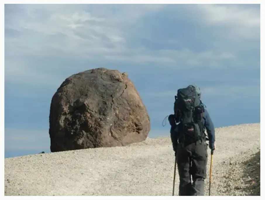
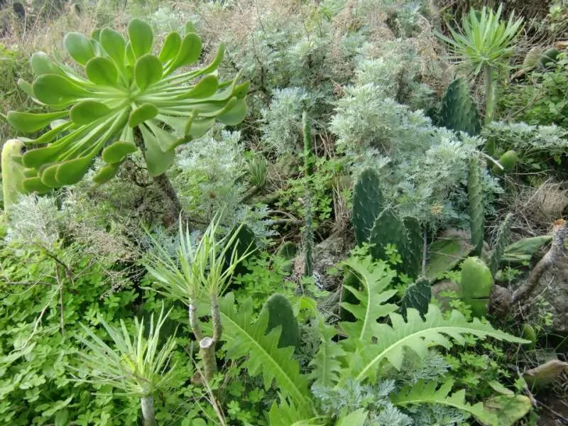
- The scenery first: beautiful and highly varied. The island has several nature parks, notably Teide, the rural park of the Anaga massif and Teno. Hike through a dry cactus-filled canyon, a ‘barranco’, then cross into a green valley with terraced crops; follow a ridge through laurel forest and suddenly discover a plunging sea view; reach Spain's highest summit, 3,718 m, through magnificent volcanic scenery with striking colour contrasts.
- Everything is set up for hiking, with very well-marked trails for day hikes or 2 or 3-day routes. In December, crowds were no problem…
- The climate allows visits in any season. In December, daytime temperatures were 19 to 23 °C between 0 and 1,000 m, with greater variations around Teide but always pleasant for hiking. In Anaga, trade winds create a thin cloud cover with lovely sunny breaks. Teide is cooler but mostly sunny. One reservation concerns January and February, when snow sometimes prevents the ascent of Teide; the refuge may close in bad conditions.
- It is not far: a 3 H flight from Nantes, making a week-long visit straightforward.
- The people are generally friendly and relaxed.
- Then there is La Laguna, a UNESCO World Heritage city. Evoking some Latin American colonial towns, it makes a very pleasant base with pastel façades, courtyards and countless historic buildings, palaces, churches and monasteries.
Some hiking information:
Maps:
A pocket guide presents the island's main hikes: ‘Ténérife’ by Klaus and Annette Wolfsperger, published by Rother. Use it to organise day hikes; it helpfully specifies possible links between routes. You can therefore easily plan a multi-day circuit with this sometimes unnecessarily detailed guide. An overview map is also useful for route planning. We used Kompass. Apart from its overall view, it is less useful than the guide because not all hiking trails appear.
When to go?
The climate allows visits all year, with the January and February reservations mentioned above. July to September are warmer and probably busier. Spring and autumn are therefore best, with spring having the edge for enjoying flowers.
Getting around:
For day walks across the island, car hire is probably most practical. For hiking routes with different start and finish points, the island has excellent bus coverage at modest cost. Beware: some secondary routes have only 2 or 3 buses a day, so check timetables in advance. There are also many inexpensive taxis, useful occasionally when no bus is available.
Accommodation:
For hotels, we naturally recommend avoiding the particularly unattractive southern tourist zone. As mentioned, La Laguna is a pleasant, fairly central base, preferable to Santa Cruz, only ¼ of an hour away: Hotel Aguere occupies a 17th-century building with a covered courtyard. Otherwise, small charming hotels and inns can be found in coastal towns.
A few campsites are also marked on the Kompass map and tourist office website.
We wild camped without problems in Anaga park. Wild camping is prohibited in Teide park. A refuge at Teide's foot allows the final ascent at night to reach the summit at dawn. Booking is essential, as there are only 36 bunks. A hotel also stands near the park visitor centre at Parador Nacional.
Which hikes:
We completed 2 routes of 3 days: one in Teide park is absolutely unmissable; the other, in Anaga park, is very pleasant.
Teide park:
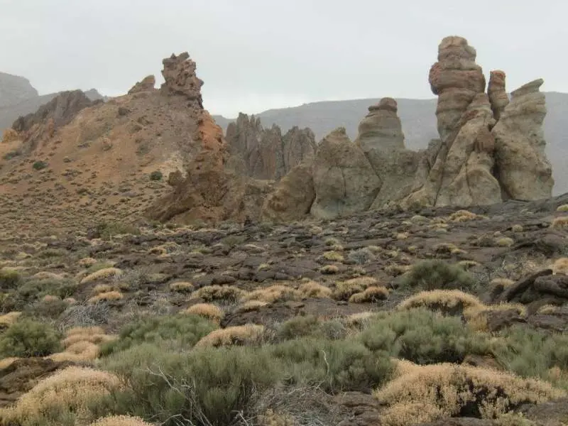
This 2.5-day route reveals the park's finest landscapes: black lava bombs on white ground, the caldera's rich colours, dawn on Teide's summit at 3,718 m, black lava flows on ochre earth, Pico Viejo crater, the stone cathedrals of Roques de Garcia, the Guajara ascent with Teide views, and contrasting black and ochre hills descending the southern side. Simply magnificent!
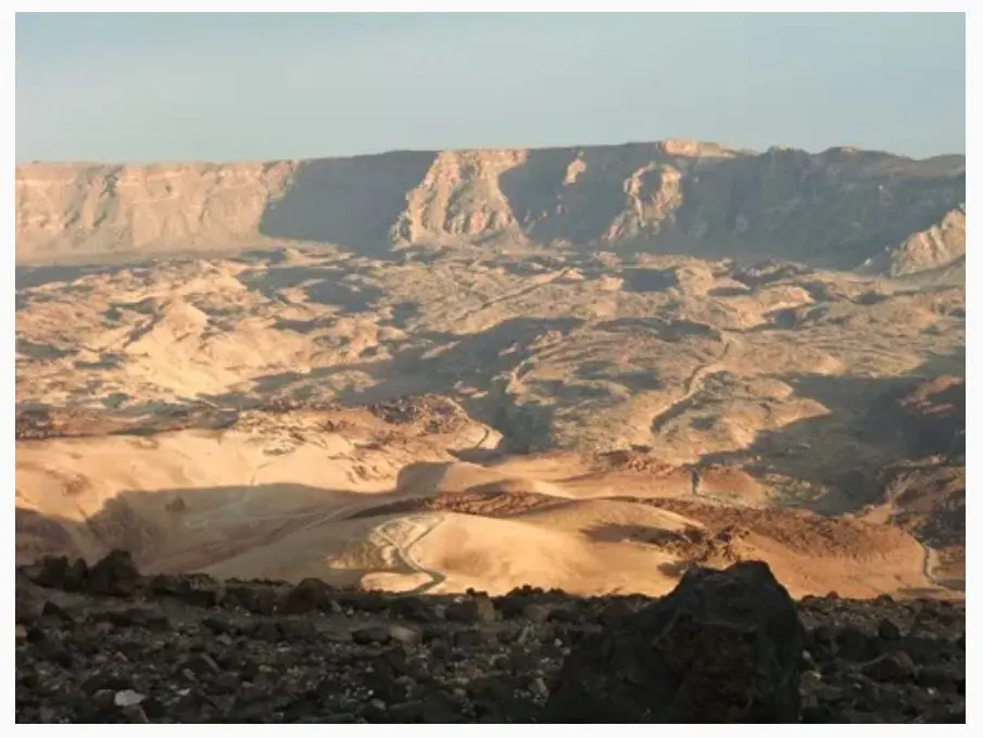
- Day 1: start early afternoon from the park visitor centre at El Portillo, 2,050 m. Access by bus or taxi from La Orotava, or bus from Los Cristianos. Cross the caldera, the immense ancient crater 16 km across, then climb Teide's slopes on a steep but clear path to Altavista refuge, 3,260 m. The refuge only opens at 17H and has no bar or meals, just 2 drinks machines, a kettle and microwave.
- Day 2: set off in darkness at 5h30 to reach the summit at dawn, around 7. A steep but straightforward 500 m climb. Pass the cable car upper station before the final ascent, where fumaroles release sulphurous fumes. Warm your hands at a hot sulphurous vent 10 m from the top. In early December, it was 1°C at the refuge at 5 in the morning and around -5°C on the summit, so bring warm clothing, including hat and gloves. Wind can intensify the cold… Magnificent sunrise and 360° views over island and ocean. Descend to the cable car and continue right across lava flows to Pico Viejo: you must climb the 50 m to the magnificent crater rim before retracing your steps and descending towards the beautiful Roques de Garcia formations. Stay at the Parador de las Canadas del Teide hotel near the visitor centre, 2,150 m, Parador Nacional.
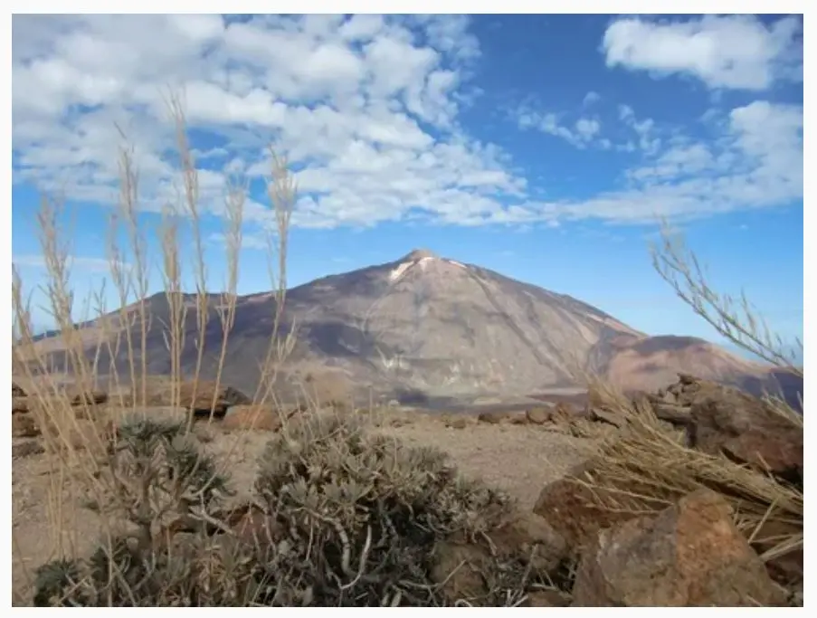
- Day 3: climb Guajara, 2,718 m, via the Degollada de Ucanca pass, a lovely but sometimes exposed path preferable to the vehicle track via Degollada de Guajara. The summit gives 360° views of Teide and the whole caldera on one side, ocean on the other. Descend southwards, with temperatures rising quickly. Enjoy more striking volcanic hills, then pass Paisaje Lunar, modest Cappadocia-style fairy chimneys, before a long forest descent to Vilaflor village. We then hitchhiked to Hotel El Nogal at La Escalona, although a bus exists: a charming hotel with indoor pool and jacuzzi, a lovely end to our hiking week.
Anaga park
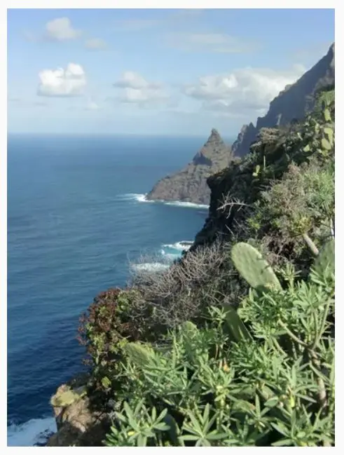
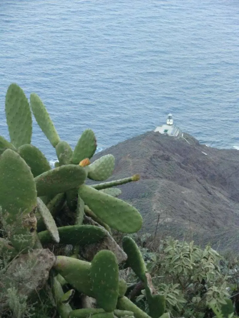
A pleasant 3-day route alternating beautiful scenery and more ordinary stretches. The best parts: the initial climb through dry, cactus-filled Barranco del Rio; descending the flowing Barranco de Tamadite, the only one with water, to a black-sand beach; sea-view promontories along the ridge after La Ensilada, ending at Montana Tafada's tip above the north coast.
- Day 1: start at Punta del Hidalgo, with several buses from La Laguna. Ascend dry Barranco del Rio, follow a ridge, then cross into a valley of terraced crops at Las Carboneras village. Wild camp on an abandoned terrace towards Taborno.
- Day 2: climb towards the village, follow the ridge and descend towards Afur. Continue through beautiful Barranco de Tamadite to the superb black-sand beach. Climb a path above the sea towards Taganana, then turn right towards forest. A steep switchback climb through woodland follows. Wild camp beside the path, 200 m from Casa Forestal de Anaga, 832 m.
- Day 3: from Casa Forestal, retrace yesterday's descent uphill for 5 min and turn right. Descend, then follow a ridge. Climb again towards El Bailadero. An unpleasant surprise: the mapped trail does not exist, so follow the road for around 5 km before rejoining the path at La Ensilada. The ridge offers superb coastal views and a developed promontory perfect for lunch. Continue slightly downhill, then climb along the ridge to Montana Tafada. Go right to the end for views of Anaga lighthouse and the coast. Retrace your steps, then 150 m after the ruined building turn left onto a path descending shortly afterwards to Chamorga. Bus to La Laguna, except public holidays!
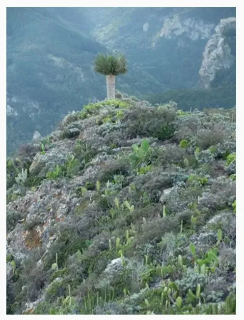
And the sea?
We only dipped our feet at an Anaga black-sand beach. For swimming, several beaches exist, including a large artificial sandy beach, Playa de las Teresitas, near San Andres, probably less touristy than the south. There are also some seawater pools, such as Punta del Hidalgo. We did not see the southern beaches.
